Professional work
Internal betaRange Studio
A desktop workspace for planning radar layouts, exploring terrain, and turning simulation results into clear engineering reports.
Application design & development
Desktop software / Geospatial / Simulation integration
Geospatial site and terrain editing
3D views and animated flythroughs
Saved designs and exportable reports
Built with
 Python
 TypeScript
 React
 FastAPI
 Qt
A closer look
Inside the workflow.
Context
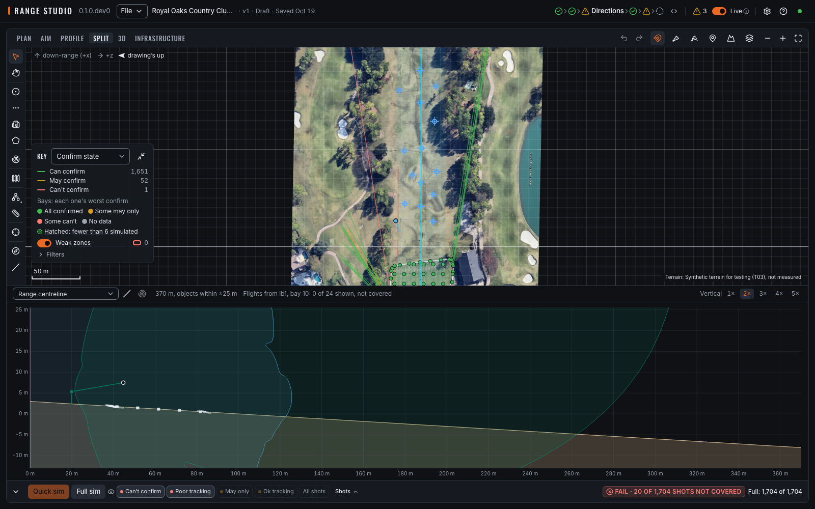
Operations managers and installers need to explain to customers and contractors how a range will work on their site and how it will be installed. Range Studio brings site geometry, terrain, radar placement and infrastructure into a shared visual plan, then uses simulated shots to check radar coverage and tracking capability.
What I built
- One design workspace: edit radars, bays, fences and infrastructure against a georeferenced site.
- Multiple views: move between plan, profile and 3D context, or watch an animated range flythrough using the same project model.
- A simulation bridge: translate application geometry into the inputs expected by the shared radar engine.
- Site communication: use the layout, simulated shots and reports to explain the proposed installation to customers and contractors.
- Useful deliverables: save versioned projects and export PDF, spreadsheet and image reports.
Design decisions
The React interface runs with a local Python service inside a desktop shell. Long-running simulation and terrain work stays separate from the editing experience. Saved results carry input and engine context, so a report can explain what produced it.
Visual context and simulation inputs also have distinct responsibilities. A detailed map can help someone understand a site without silently changing the engineering model beneath it.
Project overview
Range Studio evolved from an earlier Python/Qt companion into a broader desktop application. My work covers the application architecture, domain models, editing workflows, geospatial integration, reporting and release coordination. The underlying radar simulation foundations are shared Trackman components.
The current application is in internal beta. That stage includes operator feedback, cross-platform packaging and careful handling of changes to saved projects. The goal is a practical design workflow: make geometry easier to inspect, preserve decisions, and give an engineer something understandable to review.